Hello Everyone:
Yours Truly is having an exquisite day. Yes, Blogger is having one of those days where everything is falling her way. To celebrate this all-to-rare occasion, Blogger treated herself to a delicious hot coffee beverage. Feeling absolutely energized, shall we drain that swamp?
 |
| The Capitol Building under construction Washington D.C. pinterest.com |
"Drain the swamp" is more than just a political battle cry. Washington D.C. was literally a swamp until a group of planners, engineers, and builders took it upon themselves to create a proper capital for the newborn nation, situated between Maryland and Virginia. The word swamp brings to mind the image of a foul smelling mosquito infested landscape. Not exactly the place the founders of the United States had in mind when they envisioned "a shining city on the hill." They had a more noble location in mind not someplace that would foster rotten politics. As it turned out, the Founding Fathers were wrong in assuming that a rotten environment will foster rotten politics, even under present circumstances. Maybe the next time someone shouts "drain the swamp" at a rally, you can tell them, done and here is how.
 |
| Map of Washington D.C. worldatlas.com |
George Washington knew precisely what he was doing when chaired a three-member commission, authorized by Congress, to choose a site for the U.S. capital. There was never a question that the federal district and city had to be close to the navigable water of the Potomac River, away from the marshy Chesapeake Bay, near the bustling port city of Georgetown. President Washington was familiar with the site because it resembled his home in Mount Vernon--"a rolling riverside terrain of old tobacco fields" (savingplaces.org; Apr. 10, 2019; date accessed Apr. 22, 2019)
Locating a city near a navigable water source was typical of how many early American cities like Philadelphia and Cincinnati were settle. Washington was no exception, "built on a firm and dry riverbank" (theconversation.com; date accessed Apr. 23, 2019). The site "steadily sloped upward away from the Potomac between Rock Creek and the Anacostia River, then called the Eastern Branch of the Potomac" (Ibid). The northward direction of the land was immediately apparent to Pierre L'Enfant (nps.gov; date accessed Apr. 23, 2019), the French immigrant commissioned to lay out the streets and squares for the city. Fortuitously, he selected one high point for the presidential mansion and another for both houses of Congress. This became Capitol Hill, formerly Jenkins Hill.
 |
| Tiber Creek Washington D.C. whitehousehistory.org |
The Tiber Creek was a very lovely waterway, coursing gently southward between the White House and the Capitol, along the future location of Union Station Plaza before turning west toward present day Constitution Avenue. The western portion of the creek was re-directed toward the Washington City Canal in 1815. By the 1840s the canal was that foul infested landscape the founding fathers imagined the federal district to be because of inadequate drainage.
 |
| Early map of Washington D.C. loc.gov |
Early maps support this conclusion. In 1826 Anne Royall, perhaps the first female journalist in the U.S. and author of Sketches of History, Life and Manners, in the United States (books.google.com; date accessed Apr. 23, 2019), described
...the elevate site of the city; its undulating surface, covered with very handsome buildings....
She inventoried the city without a single reference to swamps, concluding with wee too much zeal,
...it is not in the power of the imagination to conceive a scene so replete with every species of beauty...(Ibid)
British visitors from the period would poke fun at the new city, especially the manners and pretensions of its residents, not the landscape. In 1830 Frances Trollope (gutenberg.org; date accessed Apr. 23, 2019) wrote,
I was delighted with the whole aspect of Washington, light, cheerful, and airy; it reminded me of our fashionable watering-places... (theconversation.com; date accessed Apr. 23, 2019).
The muddiest period of Washington's development came in the post-Civil War era. Decades of farming along the hinterlands of the Potomac led to erosion, sending slit downriver. As the River's rapids slowed as flowed toward the city, the slit became giant mudflats on the city side of the Potomac.
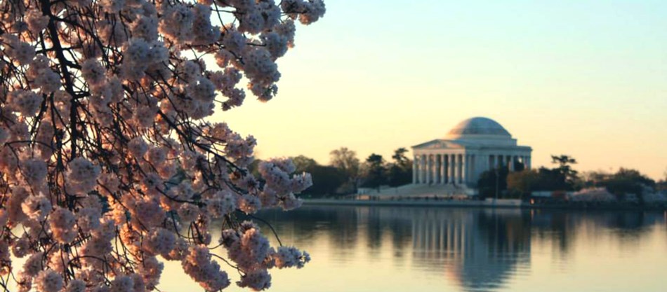 |
| The Tidal Basin Washington D.C. nps.gov |
In the late 19th century, the Army Corp of Engineers began to reconfigure the flats into the Reflecting Pool, and Tidal Basin, and acres of park land. By the way since Yours Truly has your attention, our friends at the National Trust for Historic Preservation have begun a three-year campaign to save the Tidal Basin and they need your help. Please go to savingplaces.org and sign the pledge, thanks. The park areas are home to presidential memorial and cherry blossom trees, creating a park that one would hardly describe as a "swamp."
President George Washington envisioned the new capital as metropolis with commerce and cultural eclipsing Philadelphia. The Erie Canal helped grow New York, putting a dent in President Washington's vision. The rapid growth of Baltimore also made Washington an also-ran in Mid-Atlantic trade. English commentator James Bryce wrote in the The American Commonwealth (oll.libertyfund.org; date accessed Apr. 23, 2019) that "the United States was the only great country without a true capital, but that was a dig at New York as much as at Washington" (theconversation.com; date accessed Apr. 23, 2019)
Blogger has a suggestion for all the politicians who shout "drain the swamp," enough already. The swamp has been drained, get out of your offices and take a walk around the city. Washington D.C. is filled with many neighborhoods, each with their own distinct character. Who knows you might just learn something about that swamp you want to drain.
No comments:
Post a Comment